
Bench Marks
Unveiling the hidden markers that shaped the UK’s accurate mapping – now overlooked, yet in plain sight.
They are called trackables by the enthusiasts in the Geocaching Society who go hunting for them and they are Ordnance Survey datum points. Their importance is that these were what made accurate plotting and the origination of levelling of our country possible. For those interested in joining the hunt, there is a free App online.
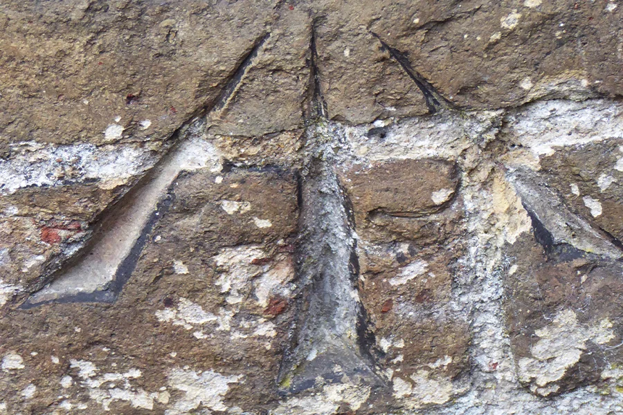
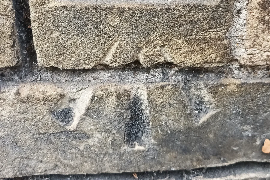
It’s said that there were about 5,000,000 of the common ones throughout G.B. but unfortunately, they are no longer regularly maintained and many have been lost to erosion, reconstruction etc. They are extremely common in urban areas, especially on buildings, with the large majority located in plain sight – yet mainly ignored by the large majority. Bench marks are normally to be recognised by the vertical arrow with a horizontal line on top. Many are not recorded so just lost to the midst of times.
The name originates from the angle iron placed into the chiselled line at the apex which then formed a bench or platform to accommodate a levelling staff. This would then be revisited periodically to record any changes in the height of what became known as the mean sea level.
Primary levelling was undertaken from 1840 when St. John’s Church in Liverpool was used, though latterly demolished. This was then replaced by a tidal pole in Victoria Dock Liverpool in 1844. However, the modern system originated primarily from a single datum point at Newlyn in Cornwall (ODN – Ordnance Datum Newlyn). Accurate heights were taken from the end of the pier and, from that, the average or mean tidal height above sea level was calculated.
This then formed the basis for 190 high accuracy benchmarks, called fundamentals, plus a further estimated half a million lower order sites throughout the country. The fundamental ones are normally spaced about 40km apart and marked as a concrete pillar with a top brass bolt.
Most are reasonable permanent markers but if there is no physical presence on the ground, they are called a spot height.
The earliest ones from about 1912 were numbered up to 3,000. Some early ones have an ‘S’ prefix before the 3, 4 or 5 number identification mark. There is also a long list of abbreviations to identify the location, such as ‘FB’ (footbridge), ‘TCB’ (telephone call box), ‘COTT’ (cottage) etc.
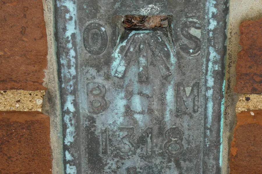
The next kind are rare being an angled/projecting bracket on a plate set onto the façade of a building. There are only about 2,600 of these.
Where there is no suitable manmade structure such as a house, bridge, or similar, bolts are often used, found driven into rock faces and similar. These are brass mushroom-shaped, round heads just over 2 inches in width, with OSBM etched/scribed to the surround.
By far the most common though are the arrows with a plate on top, chased and chiselled into brick and stone walls of our urban environment. The most prized find of these is those which have what looks like a screw at the head of the arrow, being very rare.
Bench Marks
Unveiling the hidden markers that shaped the UK's accurate mapping – now overlooked, yet in plain [...]

Imperial Lengths and Areas
Although officially only used since 1824, there was 141 years until Great Britain changed to the [...]

Ancient Marvels: Uncovering the True Identity of a Pudding Stone Beehive Quern
Discover the fascinating history behind a 60-million-year-old artifact, mistaken for Portland cement, and its journey [...]
